
Tag: projections
-
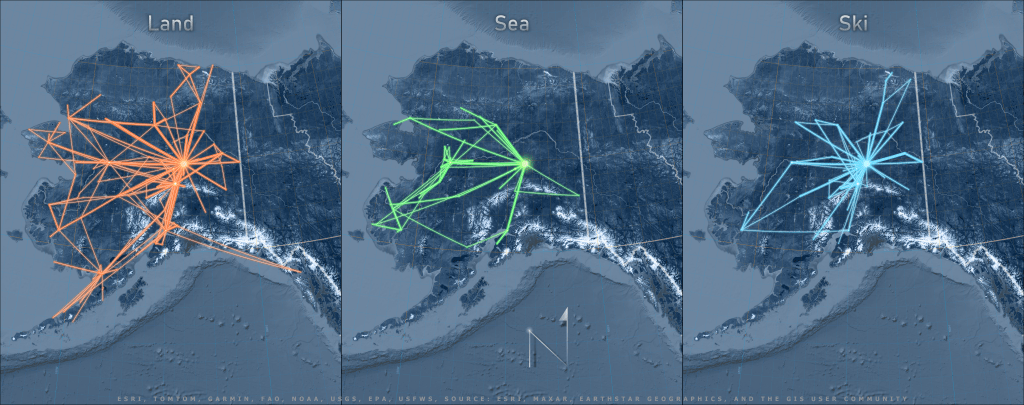
One if by land, two if by sea, three if by ski
This blog post talks about the cartographic principles and GIS workflow behind creating this map of Alaska air routes with real-life flight data using two GIS tools: geodesic lines and projected coordinate systems.
