
My favorite part of being a pilot is the opportunity to see patterns across the landscape.
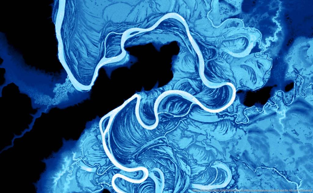
While I was working on other riverine projects this winter, I found myself distracted by Dr. Aileen Buckley’s how-to on symbology of rivers using elevation data from satellite imagery. I immediately wanted to try it out on the Koyukuk River, with it’s strata of old oxbows lining the river.
My first visit to the region was in 2016, on a trip to Galena, which is on the Yukon River. My boyfriend (who was living in Galena) had purchased a plane and we flew up along the Koyukuk River for a fishing trip. Among other sights, I was enamored with the vegetated old sloughs along the Koyukuk and Yukon Rivers, looking so much like trees rings to show the passage of time on a geologic scale.

This photograph appears as fig.35 on p.65 in: Troy Lewis Pewe (1975): Quaternary geology of Alaska. USGS Professional Paper 835. Photo in Public Domain, Link
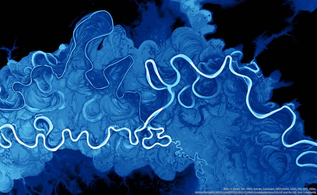
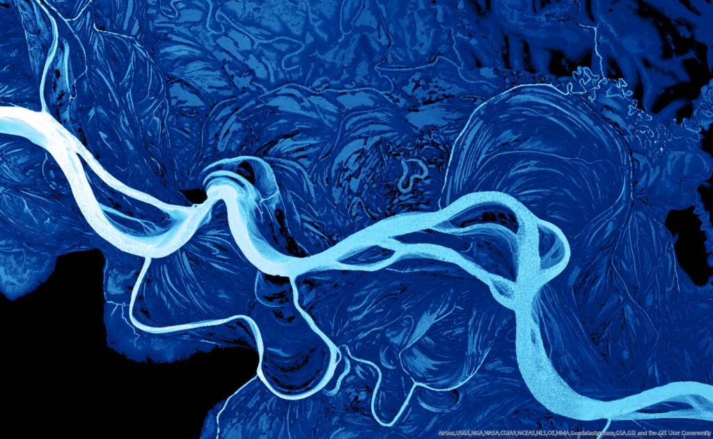
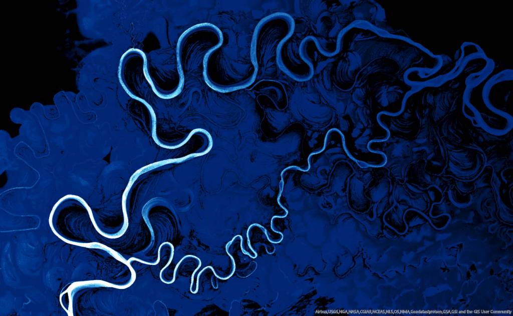
Future visits to the area (and eventually, my own solo adventures in that same plane) allowed me to further explore the unique terrain of the Innoko and Koyukuk National Wildlife Refuges. These patterns are caused by oxbow lakes, which are created when a meandering channel cuts off the oxbow neck to isolate the loop, redirecting the waters of the main channel. The cut off loop creates a lake that will eventually dry up and revegetate. Additionally, anabranching (where smaller channels break away from the main channel to join up further downstream) create many small channels that also meander and create oxbow lakes. After many millennia, the various stages of ecological succession and soil types within each former lake bed creates a distinct arc near the main channel.
Below is a Google Earth Engine timelapse of the Amazon River in Peru showing the meandering river process.
Although I see this in other areas along the Yukon while flying, it seems to be the most abundant in the Koyukuk. Why is the Koyukuk and lower part of the Yukon River prone to this topography? I don’t know. Maybe it is due to the river hydraulics or the underlying geophysical properties. I will add that question to my list of things to ask the -ologists or ecological knowledge holders of that area the next chance I get.
Until then, enjoy!

You must be logged in to post a comment.