Category: Cartography
-

Anabranching
My favorite part of being a pilot is the opportunity to see patterns across the landscape. While I was working on other riverine projects this winter, I found myself distracted by Dr. Aileen Buckley’s how-to on symbology of rivers using elevation data from satellite imagery. I immediately wanted to try it out on the Koyukuk…
-
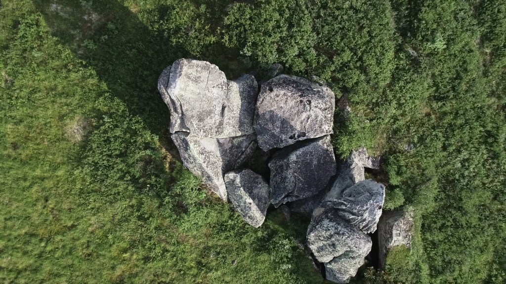
Erratic Behavior: Mapping 3D Points of Interest
For my birthday this year, I bought myself a present: The 3D Point of Interest (POI) mapping ability in DJI GS Pro. A small splurge to be sure ($10), but oh, the great joy it brought me! As soon as it was loaded on my mobile device, I immediately started my flight plan with a…
-
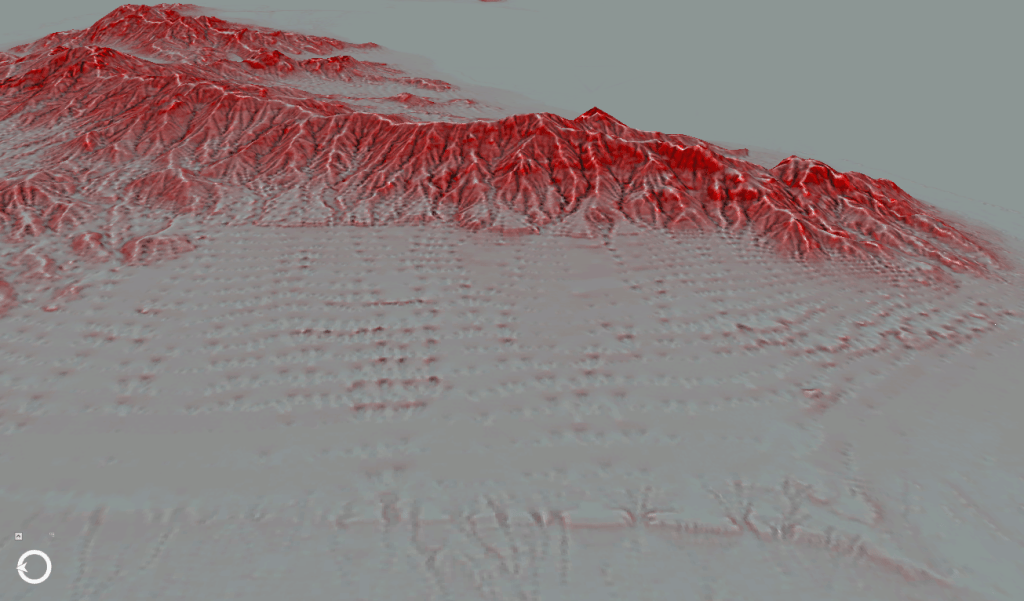
Red Relief Image Maps
A few years ago, a colleague of mine shared a paper with me about a new method of visualizing elevation data using slope gradient and convexities/concavities, called a Red Relief Image Model. I was initially skeptical – as far as I could tell, the visualization wasn’t all that different from a multi-directional hillshade with a…
