-
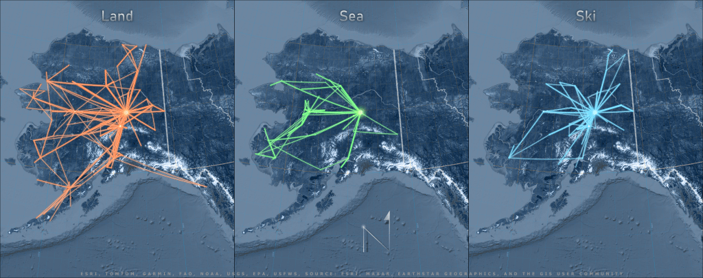
One if by land, two if by sea, three if by ski
This blog post talks about the cartographic principles and GIS workflow behind creating this map of Alaska air routes with real-life flight data using two GIS tools: geodesic lines and projected coordinate systems.
-
Nenana River Map
Earlier this summer, as a group of us planned to float the Nenana River after work one day, we discussed where to put in our boats. Sam suggested the Grassy Knoll and John, chuckling, replied, “Where do you mean when you say the ‘Grassy Knoll’?”….
-

Anabranching
My favorite part of being a pilot is the opportunity to see patterns across the landscape. While I was working on other riverine projects this winter, I found myself distracted by Dr. Aileen Buckley’s how-to on symbology of rivers using elevation data from satellite imagery. I immediately wanted to try it out on the Koyukuk…
-

Erratic Behavior: Mapping 3D Points of Interest
For my birthday this year, I bought myself a present: The 3D Point of Interest (POI) mapping ability in DJI GS Pro. A small splurge to be sure ($10), but oh, the great joy it brought me! As soon as it was loaded on my mobile device, I immediately started my flight plan with a…
-
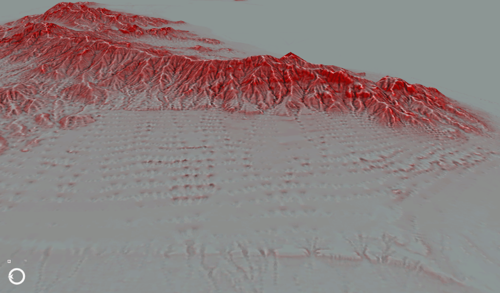
Red Relief Image Maps
A few years ago, a colleague of mine shared a paper with me about a new method of visualizing elevation data using slope gradient and convexities/concavities, called a Red Relief Image Model. I was initially skeptical – as far as I could tell, the visualization wasn’t all that different from a multi-directional hillshade with a…
-
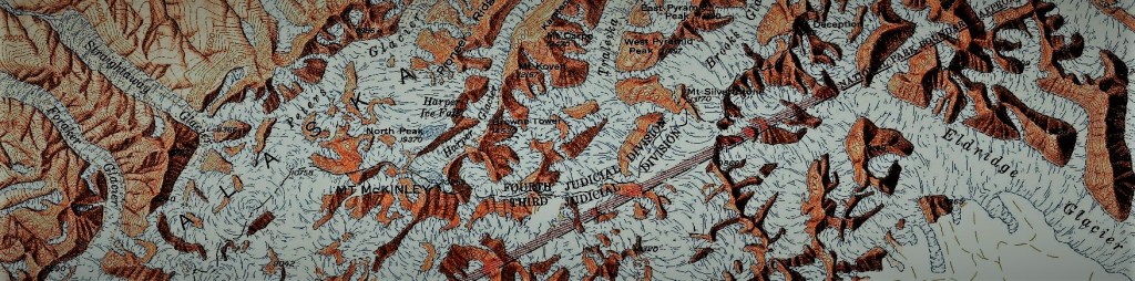
Base Layers (or How this Blog Came To Be)
Welcome to the Alaska Mapplications website! So often, Alaska is an afterthought for the average U.S. cartographer, relegated to a box in the map marginalia (nobody puts Alaska in a corner!). Alternatively, when cartographers from Outside do focus on Alaska, their lack of local knowledge is glaringly obvious (or perhaps, to be more fair, it…
